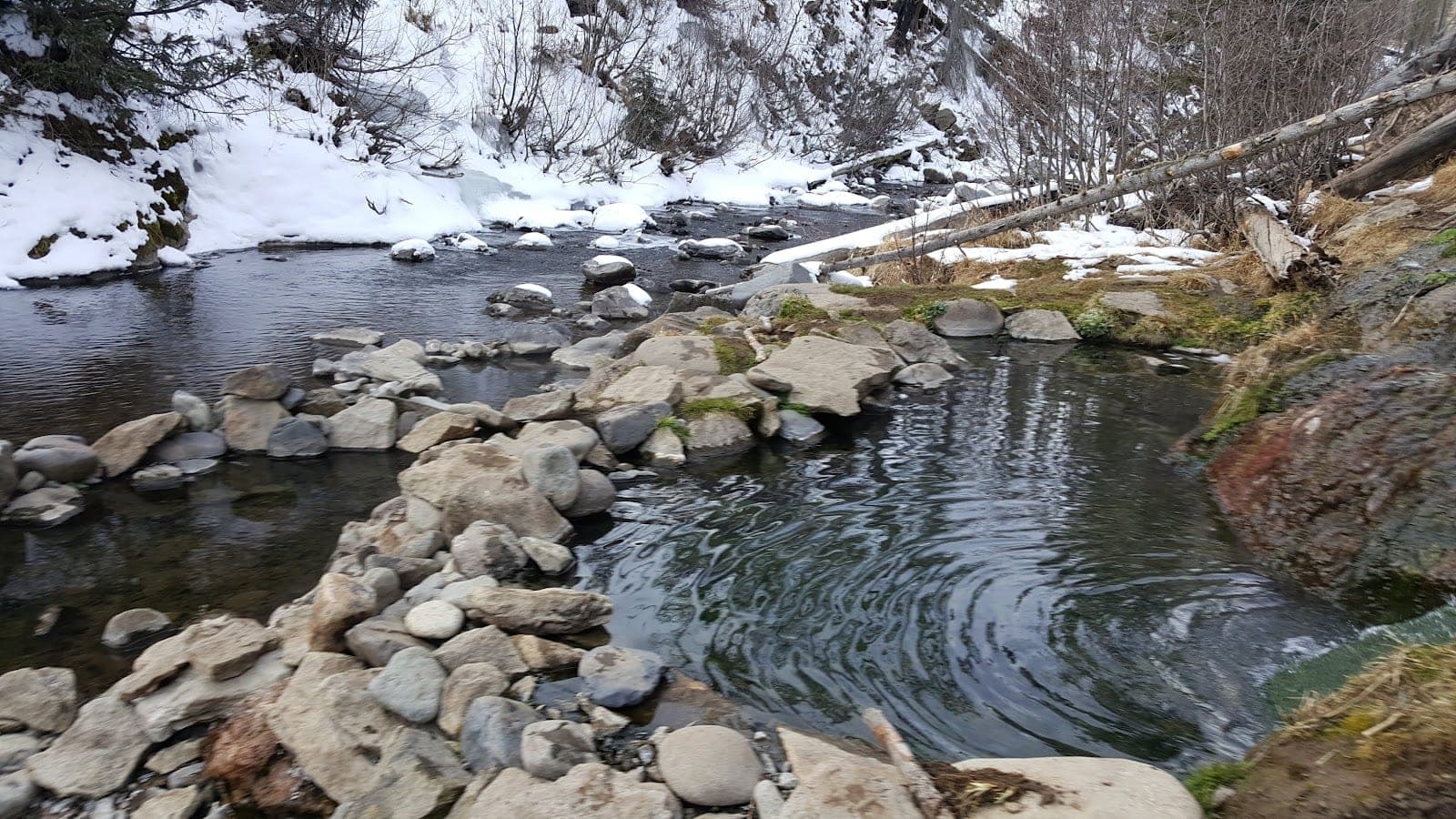
Rainbow Hot Springs
Primitive/backcountry · Pagosa Springs
- Naegleria risk
Rainbow Hot Springs lies inside the Weminuche Wilderness of San Juan National Forest, northeast of Pagosa Springs. You reach it on foot by the West Fork Trail (No. 561), which the Forest Service puts about 5.3 miles from the trailhead information board. The trail starts at 9,040 feet and follows the West Fork of the San Juan River. The springs are not visible from the trail; social trails through the camping area lead down to the pools by the river.
The first mile crosses private property, so stay on the trail. The wilderness boundary comes at 1.3 miles, and a restricted camping zone begins around mile 4.5. Camping near the springs is allowed only at nine designated sites marked with numbered posts, available first come, first served. If all are taken you must find a legal site outside the closure area, which means a long hike. Campfires are closed between the Beaver Creek Trail junction and the next river crossing.
Wilderness rules apply: groups of up to 15 people, no more than 25 people and stock combined, camps at least 100 feet from water, dogs under control, and no bicycles or drones. The area also has many standing dead trees from the 2013 West Fork Fire and a bark beetle outbreak, and flooding in October 2025 damaged parts of the route. In winter and early spring the West Fork Road is closed to vehicles, and the walk from the closure point to the springs is about 7.5 miles.
Water safety
Naegleria risk
Naegleria fowleri is an ameba that can live in warm fresh water, including naturally hot springs. Infection is rare, but it is almost always fatal, and it happens when water goes up the nose. The CDC advises keeping your head above the water in hot springs, holding your nose shut or using a nose clip if you jump or dive in, and not stirring up the sediment on the bottom.
Source: US Centers for Disease Control and PreventionGetting there
- From Pagosa Springs, drive northeast on U.S. Highway 160 for about 15 miles.
- Turn left onto West Fork Road (Forest Road 648).
- Continue about 3 miles. Pass West Fork Campground, cross the bridge over the West Fork San Juan River and bear right, then go northwest to the West Fork Trailhead.
- Hike the West Fork Trail (No. 561) about 5.3 miles to the springs. The first mile crosses private property, and the wilderness boundary is at 1.3 miles.
Amenities
Facilities
- 9 designated campsites (first come, first served)
Parking
- Limited trailhead parking (fills early in summer)
Before you go
Best time to visit: The Forest Service lists the trailhead's operating season as May to November. In winter and early spring the West Fork Road is closed to vehicles, which adds a long walk before the trail even starts. Reviewers describe the river valley as scenic, and a few went on a weekday or Sunday afternoon and had the springs to themselves.
- Plan for a full day. Reviewers say the walk to the springs feels longer than the 4 to 4.5 miles some websites claim, and the Forest Service gives about 5.3 miles each way.
- Bring plenty of water and food. There is no drinking water on the route, and several reviewers warn about the effort of the hike and the elevation.
- Start early in summer. The Forest Service says trailhead parking is limited and fills early.
- Look for the social trails to the pools near the river in the camping area; the springs are not visible from the main trail.
- Camp only at the nine numbered sites near the springs (first come, first served), and check Forest Service alerts first because of the 2025 flood damage.
Pros & cons
Pros
- Beautiful hike along the West Fork of the San Juan River
- Remote wilderness setting, often quiet on weekdays
- Free, with no fees listed by the Forest Service
- Designated campsites close to the springs
- A rewarding destination for a long day hike or overnight trip
Cons
- A long, tiring hike: many reviewers say it is further or harder than they expected
- The pools are small, with room for only a few people at a time
- Reviewers often find the water murky, with algae and silt
- Remote wilderness with no facilities beyond the campsites
Frequently asked questions
How far is the hike to Rainbow Hot Springs?
The Forest Service puts the springs about 5.3 miles from the trailhead information board on the West Fork Trail (No. 561). Reviewers give 5 to 6 miles each way, so expect a round trip of about 11 to 12 miles.
Can I camp near the springs?
Yes, but only at nine designated sites marked with numbered posts, first come, first served. If they are all taken you must find a legal site outside the restricted camping zone, which means a long hike.
Is there a fee or permit?
The Forest Service pages list no fee. They do not say whether a permit is needed, so check with the Pagosa Ranger District before you go.
Can I bring my dog?
Dogs are allowed under control under the wilderness rules. The Forest Service has extra rules for dogs in the camping zone, so check the current order.
Is the trail open in winter?
The West Fork Road is closed to vehicles in winter and early spring, and the walk from the closure point to the springs is about 7.5 miles each way.
Are the pools big?
Reviewers describe them as small, with room for a handful of people, and some say the water is murky with algae. Nothing official gives pool sizes.
Nearby hot springs
- The Springs Resort · about 17 miles away
- Pinkerton Hot Springs · about 47 miles away
- Durango Hot Springs Resort & Spa · about 50 miles away
Last checked October 28, 2026
Sources: fs.usda.gov, cdc.gov